Distance from Mocoa to Tame
Distance between Mocoa and Tame is 804 kilometers (499 miles).
Driving distance from Mocoa to Tame is 1165 kilometers (724 miles).
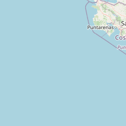
Distance Map Between Mocoa and Tame
Mocoa, Colombia ↔ Tame, Arauca, Colombia = 499 miles = 804 km.


How far is it between Mocoa and Tame
Mocoa is located in Colombia with (1.1493,-76.6466) coordinates and Tame is located in Colombia with (6.461,-71.73) coordinates. The calculated flying distance from Mocoa to Tame is equal to 499 miles which is equal to 804 km.
If you want to go by car, the driving distance between Mocoa and Tame is 1165.32 km. If you ride your car with an average speed of 112 kilometers/hour (70 miles/h), travel time will be 10 hours 24 minutes. Please check the avg. speed travel time table on the right for various options.
Difference between fly and go by a car is 361 km.
| City/Place | Latitude and Longitude | GPS Coordinates |
|---|---|---|
| Mocoa | 1.1493, -76.6466 | 1° 8´ 57.5880'' N 76° 38´ 47.7960'' W |
| Tame | 6.461, -71.73 | 6° 27´ 39.5640'' N 71° 43´ 48.1440'' W |
Estimated Travel Time Between Mocoa and Tame
| Average Speed | Travel Time |
|---|---|
| 30 mph (48 km/h) | 24 hours 16 minutes |
| 40 mph (64 km/h) | 18 hours 12 minutes |
| 50 mph (80 km/h) | 14 hours 33 minutes |
| 60 mph (97 km/h) | 12 hours 00 minutes |
| 70 mph (112 km/h) | 10 hours 24 minutes |
| 75 mph (120 km/h) | 09 hours 42 minutes |
Related Distances from Mocoa
| Cities | Distance |
|---|---|
| Mocoa to Pasto | 148 km |
| Mocoa to Pereira | 610 km |
| Mocoa to Popayan | 278 km |
| Mocoa to Santa Marta | 1472 km |
| Mocoa to Tame | 1165 km |
Related Distances to Tame
| Cities | Distance |
|---|---|
| Bogota to Tame | 442 km |
| Mocoa to Tame | 1165 km |
| Cali to Tame | 999 km |
| Arauca to Tame | 180 km |
| Cucuta to Tame | 298 km |