Distance from Kandi to Sainthia
Distance between Kandi and Sainthia is 37 kilometers (23 miles).
Driving distance from Kandi to Sainthia is 41 kilometers (25 miles).
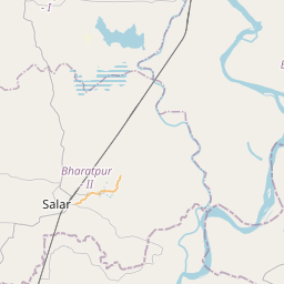
Distance Map Between Kandi and Sainthia
Kandi, Kolkata, India ↔ Sainthia, Kolkata, India = 23 miles = 37 km.


How far is it between Kāndi and Sainthia
Kandi is located in India with (23.9595,88.0402) coordinates and Sainthia is located in India with (23.9483,87.6805) coordinates. The calculated flying distance from Kandi to Sainthia is equal to 23 miles which is equal to 37 km.
If you want to go by car, the driving distance between Kandi and Sainthia is 40.56 km. If you ride your car with an average speed of 112 kilometers/hour (70 miles/h), travel time will be 00 hours 21 minutes. Please check the avg. speed travel time table on the right for various options.
Difference between fly and go by a car is 4 km.
| City/Place | Latitude and Longitude | GPS Coordinates |
|---|---|---|
| Kandi | 23.9595, 88.0402 | 23° 57´ 34.0560'' N 88° 2´ 24.6480'' E |
| Sainthia | 23.9483, 87.6805 | 23° 56´ 53.7360'' N 87° 40´ 49.6200'' E |
Estimated Travel Time Between Kāndi and Sainthia
| Average Speed | Travel Time |
|---|---|
| 30 mph (48 km/h) | 00 hours 50 minutes |
| 40 mph (64 km/h) | 00 hours 38 minutes |
| 50 mph (80 km/h) | 00 hours 30 minutes |
| 60 mph (97 km/h) | 00 hours 25 minutes |
| 70 mph (112 km/h) | 00 hours 21 minutes |
| 75 mph (120 km/h) | 00 hours 20 minutes |
Related Distances from Kandi
| Cities | Distance |
|---|---|
| Kandi 2 to Murshidabad | 42 km |
| Kandi 2 to Sainthia | 41 km |
| Kandi 2 to Kharagpur | 228 km |
| Kandi 2 to Krishnanagar | 109 km |
| Kandi 2 to Lalgola | 73 km |
Related Distances to Sainthia
| Cities | Distance |
|---|---|
| Kandi 2 to Sainthia | 41 km |
| Durgapur to Sainthia | 83 km |
| Bolpur to Sainthia | 34 km |
| Asansol to Sainthia | 92 km |
| Bankura to Sainthia | 126 km |