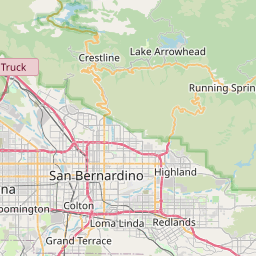
Distance from Colton to Carson
Distance between Colton and Carson is 93 kilometers (58 miles).
Driving distance from Colton to Carson is 113 kilometers (71 miles).
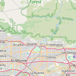
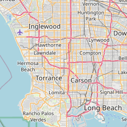
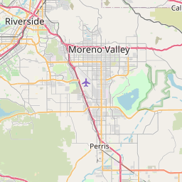
Distance Map Between Colton and Carson
Colton, Sacramento, United States ↔ Carson, Sacramento, United States = 58 miles = 93 km.

How far is it between Colton and Carson
Colton is located in United States with (34.0739,-117.3137) coordinates and Carson is located in United States with (33.8314,-118.282) coordinates. The calculated flying distance from Colton to Carson is equal to 58 miles which is equal to 93 km.
If you want to go by car, the driving distance between Colton and Carson is 113.46 km. If you ride your car with an average speed of 112 kilometers/hour (70 miles/h), travel time will be 01 hours 00 minutes. Please check the avg. speed travel time table on the right for various options.
Difference between fly and go by a car is 20 km.
| City/Place | Latitude and Longitude | GPS Coordinates |
|---|---|---|
| Colton | 34.0739, -117.3137 | 34° 4´ 26.0400'' N 117° 18´ 49.1400'' W |
| Carson | 33.8314, -118.282 | 33° 49´ 53.0760'' N 118° 16´ 55.2720'' W |
Estimated Travel Time Between Colton and Carson
| Average Speed | Travel Time |
|---|---|
| 30 mph (48 km/h) | 02 hours 21 minutes |
| 40 mph (64 km/h) | 01 hours 46 minutes |
| 50 mph (80 km/h) | 01 hours 25 minutes |
| 60 mph (97 km/h) | 01 hours 10 minutes |
| 70 mph (112 km/h) | 01 hours 00 minutes |
| 75 mph (120 km/h) | 00 hours 56 minutes |
Related Distances from Colton
| Cities | Distance |
|---|---|
| Colton to Fillmore | 175 km |
| Colton to Carson | 113 km |
| Colton to Adelanto | 68 km |
| Colton to Bakersfield | 265 km |
| Colton to Berkeley | 688 km |
Related Distances to Carson
| Cities | Distance |
|---|---|
| Los Angeles to Carson | 28 km |
| Long Beach to Carson | 20 km |
| Compton to Carson | 14 km |
| Salt Lake City to Carson City | 859 km |
| Olympia to Carson City | 1086 km |