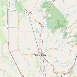
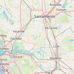
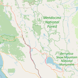
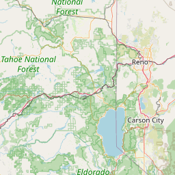
Distance from Chico to Bay Point
Distance between Chico and Bay Point is 189 kilometers (118 miles).
Driving distance from Chico to Bay Point is 252 kilometers (157 miles).
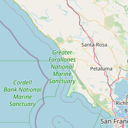
Distance Map Between Chico and Bay Point
Chico, Sacramento, United States ↔ Bay Point, Sacramento, United States = 118 miles = 189 km.


How far is it between Chico and Bay Point
Chico is located in United States with (39.7285,-121.8375) coordinates and Bay Point is located in United States with (38.0291,-121.9616) coordinates. The calculated flying distance from Chico to Bay Point is equal to 118 miles which is equal to 189 km.
If you want to go by car, the driving distance between Chico and Bay Point is 252.02 km. If you ride your car with an average speed of 112 kilometers/hour (70 miles/h), travel time will be 02 hours 15 minutes. Please check the avg. speed travel time table on the right for various options.
Difference between fly and go by a car is 63 km.
| City/Place | Latitude and Longitude | GPS Coordinates |
|---|---|---|
| Chico | 39.7285, -121.8375 | 39° 43´ 42.5640'' N 121° 50´ 14.9280'' W |
| Bay Point | 38.0291, -121.9616 | 38° 1´ 44.7240'' N 121° 57´ 41.8680'' W |
Estimated Travel Time Between Chico and Bay Point
| Average Speed | Travel Time |
|---|---|
| 30 mph (48 km/h) | 05 hours 15 minutes |
| 40 mph (64 km/h) | 03 hours 56 minutes |
| 50 mph (80 km/h) | 03 hours 09 minutes |
| 60 mph (97 km/h) | 02 hours 35 minutes |
| 70 mph (112 km/h) | 02 hours 15 minutes |
| 75 mph (120 km/h) | 02 hours 06 minutes |
Related Distances from Chico
| Cities | Distance |
|---|---|
| Chico to Berkeley | 262 km |
| Chico to Bakersfield | 597 km |
| Chico to Castro Valley | 294 km |
| Chico to Bay Point | 252 km |
| Chico to Anaheim | 802 km |
Related Distances to Bay Point
| Cities | Distance |
|---|---|
| Los Angeles to Bay Point | 584 km |
| San Diego to Bay Point | 778 km |
| Stockton to Bay Point | 74 km |
| San Jose to Bay Point | 101 km |
| Fremont to Bay Point | 74 km |