Distance from Quang Ngai to Hanoi
Distance between Quang Ngai and Hanoi is 727 kilometers (452 miles).
Driving distance from Quang Ngai to Hanoi is 898 kilometers (558 miles).
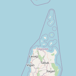
Distance Map Between Quang Ngai and Hanoi
Quang Ngai, Vietnam ↔ Hanoi, Vietnam = 452 miles = 727 km.


How far is it between Quảng Ngãi and Hanoi
Quang Ngai is located in Vietnam with (15.1205,108.7923) coordinates and Hanoi is located in Vietnam with (21.0245,105.8412) coordinates. The calculated flying distance from Quang Ngai to Hanoi is equal to 452 miles which is equal to 727 km.
If you want to go by car, the driving distance between Quang Ngai and Hanoi is 897.5 km. If you ride your car with an average speed of 112 kilometers/hour (70 miles/h), travel time will be 08 hours 00 minutes. Please check the avg. speed travel time table on the right for various options.
Difference between fly and go by a car is 171 km.
| City/Place | Latitude and Longitude | GPS Coordinates |
|---|---|---|
| Quang Ngai | 15.1205, 108.7923 | 15° 7´ 13.6920'' N 108° 47´ 32.3520'' E |
| Hanoi | 21.0245, 105.8412 | 21° 1´ 28.2000'' N 105° 50´ 28.2120'' E |
Estimated Travel Time Between Quảng Ngãi and Hanoi
| Average Speed | Travel Time |
|---|---|
| 30 mph (48 km/h) | 18 hours 41 minutes |
| 40 mph (64 km/h) | 14 hours 01 minutes |
| 50 mph (80 km/h) | 11 hours 13 minutes |
| 60 mph (97 km/h) | 09 hours 15 minutes |
| 70 mph (112 km/h) | 08 hours 00 minutes |
| 75 mph (120 km/h) | 07 hours 28 minutes |
Related Distances from Quang Ngai
| Cities | Distance |
|---|---|
| Quang Ngai to Ho Chi Minh City | 740 km |
| Quang Ngai to Qui Nhon | 190 km |
| Quang Ngai to Da Nang | 135 km |
| Quang Ngai to Kon Tum | 187 km |
| Quang Ngai to Tam Ky | 68 km |
Related Distances to Hanoi
| Cities | Distance |
|---|---|
| Ho Chi Minh City to Hanoi | 1616 km |
| Da Nang to Hanoi | 827 km |
| Haiphong to Hanoi | 103 km |
| Bac Ninh to Hanoi | 38 km |
| Hue to Hanoi | 669 km |