Distance from Midlothian to Keller
Distance between Midlothian and Keller is 56 kilometers (35 miles).
Driving distance from Midlothian to Keller is 69 kilometers (43 miles).
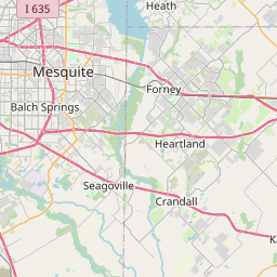
Distance Map Between Midlothian and Keller
Midlothian, Austin, United States ↔ Keller, Austin, United States = 35 miles = 56 km.


How far is it between Midlothian and Keller
Midlothian is located in United States with (32.4824,-96.9945) coordinates and Keller is located in United States with (32.9346,-97.2517) coordinates. The calculated flying distance from Midlothian to Keller is equal to 35 miles which is equal to 56 km.
If you want to go by car, the driving distance between Midlothian and Keller is 68.77 km. If you ride your car with an average speed of 112 kilometers/hour (70 miles/h), travel time will be 00 hours 36 minutes. Please check the avg. speed travel time table on the right for various options.
Difference between fly and go by a car is 13 km.
| City/Place | Latitude and Longitude | GPS Coordinates |
|---|---|---|
| Midlothian | 32.4824, -96.9945 | 32° 28´ 56.4960'' N 96° 59´ 40.0200'' W |
| Keller | 32.9346, -97.2517 | 32° 56´ 4.4520'' N 97° 15´ 6.0480'' W |
Estimated Travel Time Between Midlothian and Keller
| Average Speed | Travel Time |
|---|---|
| 30 mph (48 km/h) | 01 hours 25 minutes |
| 40 mph (64 km/h) | 01 hours 04 minutes |
| 50 mph (80 km/h) | 00 hours 51 minutes |
| 60 mph (97 km/h) | 00 hours 42 minutes |
| 70 mph (112 km/h) | 00 hours 36 minutes |
| 75 mph (120 km/h) | 00 hours 34 minutes |
Related Distances from Midlothian
| Cities | Distance |
|---|---|
| Midlothian to Dallas | 41 km |
| Midlothian to Mansfield 2 | 18 km |
| Midlothian to Arlington | 45 km |
| Midlothian to Cedar Hill | 13 km |
| Midlothian to Desoto | 22 km |
Related Distances to Keller
| Cities | Distance |
|---|---|
| Weatherford to Keller | 70 km |
| Texas City to Keller | 506 km |
| Lewisville to Keller | 38 km |
| North Richland Hills to Keller | 14 km |
| Victoria 3 to Keller | 527 km |