Distance from Lynbrook to Hauppauge
Distance between Lynbrook and Hauppauge is 44 kilometers (27 miles).
Driving distance from Lynbrook to Hauppauge is 55 kilometers (34 miles).
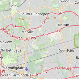
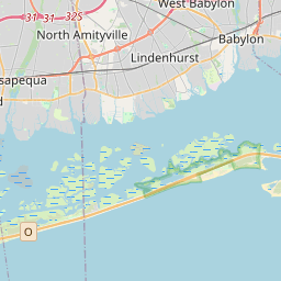
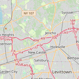
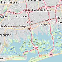
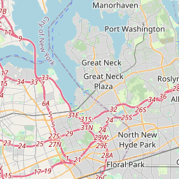
Distance Map Between Lynbrook and Hauppauge
Lynbrook, Albany, United States ↔ Hauppauge, Albany, United States = 27 miles = 44 km.


How far is it between Lynbrook and Hauppauge
Lynbrook is located in United States with (40.6548,-73.6718) coordinates and Hauppauge is located in United States with (40.8257,-73.2026) coordinates. The calculated flying distance from Lynbrook to Hauppauge is equal to 27 miles which is equal to 44 km.
If you want to go by car, the driving distance between Lynbrook and Hauppauge is 54.51 km. If you ride your car with an average speed of 112 kilometers/hour (70 miles/h), travel time will be 00 hours 29 minutes. Please check the avg. speed travel time table on the right for various options.
Difference between fly and go by a car is 11 km.
| City/Place | Latitude and Longitude | GPS Coordinates |
|---|---|---|
| Lynbrook | 40.6548, -73.6718 | 40° 39´ 17.3880'' N 73° 40´ 18.4800'' W |
| Hauppauge | 40.8257, -73.2026 | 40° 49´ 32.3400'' N 73° 12´ 9.3960'' W |
Estimated Travel Time Between Lynbrook and Hauppauge
| Average Speed | Travel Time |
|---|---|
| 30 mph (48 km/h) | 01 hours 08 minutes |
| 40 mph (64 km/h) | 00 hours 51 minutes |
| 50 mph (80 km/h) | 00 hours 40 minutes |
| 60 mph (97 km/h) | 00 hours 33 minutes |
| 70 mph (112 km/h) | 00 hours 29 minutes |
| 75 mph (120 km/h) | 00 hours 27 minutes |
Related Distances from Lynbrook
| Cities | Distance |
|---|---|
| Lynbrook to Huntington 2 | 41 km |
| Lynbrook to Deer Park 2 | 37 km |
| Lynbrook to Hicksville | 26 km |
| Lynbrook to Long Beach 2 | 10 km |
| Lynbrook to Commack | 50 km |
Related Distances to Hauppauge
| Cities | Distance |
|---|---|
| Huntington 2 to Hauppauge | 24 km |
| New York City to Hauppauge | 78 km |
| Melville to Hauppauge | 21 km |
| Ronkonkoma to Hauppauge | 9 km |
| Holbrook to Hauppauge | 12 km |