Distance from Eitorf to Herzogenrath
Distance between Eitorf and Herzogenrath is 95 kilometers (59 miles).
Driving distance from Eitorf to Herzogenrath is 124 kilometers (77 miles).
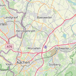
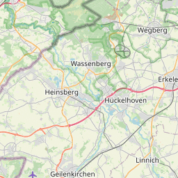
Distance Map Between Eitorf and Herzogenrath
Eitorf, Dusseldorf, Germany ↔ Herzogenrath, Dusseldorf, Germany = 59 miles = 95 km.


How far is it between Eitorf and Herzogenrath
Eitorf is located in Germany with (50.7667,7.45) coordinates and Herzogenrath is located in Germany with (50.8707,6.1014) coordinates. The calculated flying distance from Eitorf to Herzogenrath is equal to 59 miles which is equal to 95 km.
If you want to go by car, the driving distance between Eitorf and Herzogenrath is 124.23 km. If you ride your car with an average speed of 112 kilometers/hour (70 miles/h), travel time will be 01 hours 06 minutes. Please check the avg. speed travel time table on the right for various options.
Difference between fly and go by a car is 29 km.
| City/Place | Latitude and Longitude | GPS Coordinates |
|---|---|---|
| Eitorf | 50.7667, 7.45 | 50° 46´ 0.0120'' N 7° 27´ 0.0000'' E |
| Herzogenrath | 50.8707, 6.1014 | 50° 52´ 14.4120'' N 6° 6´ 4.8960'' E |
Estimated Travel Time Between Eitorf and Herzogenrath
| Average Speed | Travel Time |
|---|---|
| 30 mph (48 km/h) | 02 hours 35 minutes |
| 40 mph (64 km/h) | 01 hours 56 minutes |
| 50 mph (80 km/h) | 01 hours 33 minutes |
| 60 mph (97 km/h) | 01 hours 16 minutes |
| 70 mph (112 km/h) | 01 hours 06 minutes |
| 75 mph (120 km/h) | 01 hours 02 minutes |
Related Distances from Eitorf
| Cities | Distance |
|---|---|
| Eitorf to Wuppertal | 96 km |
| Eitorf to Koeln | 52 km |
| Eitorf to Hilden | 80 km |
| Eitorf to Lunen | 148 km |
| Eitorf to Recklinghausen | 137 km |
Related Distances to Herzogenrath
| Cities | Distance |
|---|---|
| Aachen to Herzogenrath | 13 km |
| Dortmund to Herzogenrath | 162 km |
| Bonn to Herzogenrath | 96 km |
| Essen to Herzogenrath | 121 km |
| Eschweiler to Herzogenrath | 16 km |