Distance from Durham to Stevenage
Distance between Durham and Stevenage is 332 kilometers (207 miles).
Driving distance from Durham to Stevenage is 371 kilometers (231 miles).
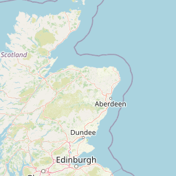
Distance Map Between Durham and Stevenage
Durham, London, United Kingdom ↔ Stevenage, London, United Kingdom = 207 miles = 332 km.


How far is it between Durham and Stevenage
Durham is located in United Kingdom with (54.7768,-1.5757) coordinates and Stevenage is located in United Kingdom with (51.9022,-0.2026) coordinates. The calculated flying distance from Durham to Stevenage is equal to 207 miles which is equal to 332 km.
If you want to go by car, the driving distance between Durham and Stevenage is 371.19 km. If you ride your car with an average speed of 112 kilometers/hour (70 miles/h), travel time will be 03 hours 18 minutes. Please check the avg. speed travel time table on the right for various options.
Difference between fly and go by a car is 39 km.
| City/Place | Latitude and Longitude | GPS Coordinates |
|---|---|---|
| Durham | 54.7768, -1.5757 | 54° 46´ 36.3360'' N 1° 34´ 32.3760'' W |
| Stevenage | 51.9022, -0.2026 | 51° 54´ 8.0640'' N 0° 12´ 9.2160'' W |
Estimated Travel Time Between Durham and Stevenage
| Average Speed | Travel Time |
|---|---|
| 30 mph (48 km/h) | 07 hours 43 minutes |
| 40 mph (64 km/h) | 05 hours 47 minutes |
| 50 mph (80 km/h) | 04 hours 38 minutes |
| 60 mph (97 km/h) | 03 hours 49 minutes |
| 70 mph (112 km/h) | 03 hours 18 minutes |
| 75 mph (120 km/h) | 03 hours 05 minutes |
Related Distances from Durham
| Cities | Distance |
|---|---|
| Durham 2 to Newcastle Upon Tyne | 29 km |
| Durham 2 to Manchester | 208 km |
| Durham 2 to City Of London | 442 km |
| Durham 2 to York | 121 km |
| Durham 2 to Liverpool | 257 km |
Related Distances to Stevenage
| Cities | Distance |
|---|---|
| Luton to Stevenage | 24 km |
| City Of London to Stevenage | 54 km |
| Hemel Hempstead to Stevenage | 39 km |
| Cambridge to Stevenage | 48 km |
| Coventry to Stevenage | 119 km |