Distance from Dong Ha to Thanh pho Bac Lieu
Distance between Dong Ha and Thanh pho Bac Lieu is 849 kilometers (528 miles).
Driving distance from Dong Ha to Thanh pho Bac Lieu is 1281 kilometers (796 miles).
Distance Map Between Dong Ha and Thanh pho Bac Lieu
Dong Ha, Vietnam ↔ Thanh pho Bac Lieu, Vietnam = 528 miles = 849 km.


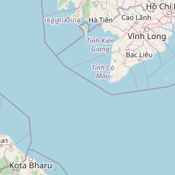


How far is it between Ðông Hà and Thành phố Bạc Liêu
Dong Ha is located in Vietnam with (16.8163,107.1003) coordinates and Thanh pho Bac Lieu is located in Vietnam with (9.2941,105.7278) coordinates. The calculated flying distance from Dong Ha to Thanh pho Bac Lieu is equal to 528 miles which is equal to 849 km.
If you want to go by car, the driving distance between Dong Ha and Thanh pho Bac Lieu is 1280.83 km. If you ride your car with an average speed of 112 kilometers/hour (70 miles/h), travel time will be 11 hours 26 minutes. Please check the avg. speed travel time table on the right for various options.
Difference between fly and go by a car is 432 km.
| City/Place | Latitude and Longitude | GPS Coordinates |
|---|---|---|
| Dong Ha | 16.8163, 107.1003 | 16° 48´ 58.5000'' N 107° 6´ 1.1160'' E |
| Thanh pho Bac Lieu | 9.2941, 105.7278 | 9° 17´ 38.9040'' N 105° 43´ 39.9360'' E |
Estimated Travel Time Between Ðông Hà and Thành phố Bạc Liêu
| Average Speed | Travel Time |
|---|---|
| 30 mph (48 km/h) | 26 hours 41 minutes |
| 40 mph (64 km/h) | 20 hours 00 minutes |
| 50 mph (80 km/h) | 16 hours 00 minutes |
| 60 mph (97 km/h) | 13 hours 12 minutes |
| 70 mph (112 km/h) | 11 hours 26 minutes |
| 75 mph (120 km/h) | 10 hours 40 minutes |
Related Distances from Dong Ha
| Cities | Distance |
|---|---|
| Dong Ha to Hue | 82 km |
| Dong Ha to Ho Chi Minh City | 1087 km |
| Dong Ha to Hanoi | 696 km |
| Dong Ha to Hoi An | 203 km |
| Dong Ha to Lao Cai | 882 km |
Related Distances to Thanh pho Bac Lieu
| Cities | Distance |
|---|---|
| Bac Giang to Thanh Pho Bac Lieu | 1817 km |
| Bac Kan to Thanh Pho Bac Lieu | 1929 km |
| Phan Rang Thap Cham to Thanh Pho Bac Lieu | 592 km |
| Bac Ninh to Thanh Pho Bac Lieu | 1798 km |
| Tra Vinh to Thanh Pho Bac Lieu | 115 km |