Distance from Alsdorf to Netphen
Distance between Alsdorf and Netphen is 136 kilometers (84 miles).
Driving distance from Alsdorf to Netphen is 170 kilometers (106 miles).
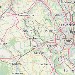
Distance Map Between Alsdorf and Netphen
Alsdorf, Dusseldorf, Germany ↔ Netphen, Dusseldorf, Germany = 84 miles = 136 km.


How far is it between Alsdorf and Netphen
Alsdorf is located in Germany with (50.8767,6.164) coordinates and Netphen is located in Germany with (50.9167,8.1) coordinates. The calculated flying distance from Alsdorf to Netphen is equal to 84 miles which is equal to 136 km.
If you want to go by car, the driving distance between Alsdorf and Netphen is 169.9 km. If you ride your car with an average speed of 112 kilometers/hour (70 miles/h), travel time will be 01 hours 31 minutes. Please check the avg. speed travel time table on the right for various options.
Difference between fly and go by a car is 34 km.
| City/Place | Latitude and Longitude | GPS Coordinates |
|---|---|---|
| Alsdorf | 50.8767, 6.164 | 50° 52´ 36.2280'' N 6° 9´ 50.3640'' E |
| Netphen | 50.9167, 8.1 | 50° 55´ 0.0120'' N 8° 5´ 60.0000'' E |
Estimated Travel Time Between Alsdorf and Netphen
| Average Speed | Travel Time |
|---|---|
| 30 mph (48 km/h) | 03 hours 32 minutes |
| 40 mph (64 km/h) | 02 hours 39 minutes |
| 50 mph (80 km/h) | 02 hours 07 minutes |
| 60 mph (97 km/h) | 01 hours 45 minutes |
| 70 mph (112 km/h) | 01 hours 31 minutes |
| 75 mph (120 km/h) | 01 hours 24 minutes |
Related Distances from Alsdorf
| Cities | Distance |
|---|---|
| Alsdorf to Herford | 264 km |
| Alsdorf to Koeln | 69 km |
| Alsdorf to Iserlohn | 165 km |
| Alsdorf to Grevenbroich | 55 km |
| Alsdorf to Stolberg | 18 km |
Related Distances to Netphen
| Cities | Distance |
|---|---|
| Monchengladbach to Netphen | 170 km |
| Aachen to Netphen | 175 km |
| Lunen to Netphen | 120 km |
| Dortmund to Netphen | 108 km |
| Bruhl to Netphen | 113 km |